


Looking for a scenic coastal walk in North Yorkshire? Take our Saltburn Walk, developed in collaboration with Walks Around Britain, and enjoy stunning seaside views. This circular walk will take you from Saltburn train station to the highest point on this section of coast and along the magnificent Cleveland Way!
Saltburn Walk Details:
- Walking distance – 5 miles / 8 km
- Minimum time – 3 hours
- Grade – Medium – Some uneven paths and challenging climbs.
- Map – OS Landranger 94 / Explorer 306
- Dog walk friendliness – Must be kept on leads.
- Nearest train station – Saltburn train station.
On mobile? Download the condensed Saltburn Walk PDF guide.;
Download the Saltburn-by-the-Sea walking guide (PDF)
Saltburn Walking / Hiking Route Details
Step 1
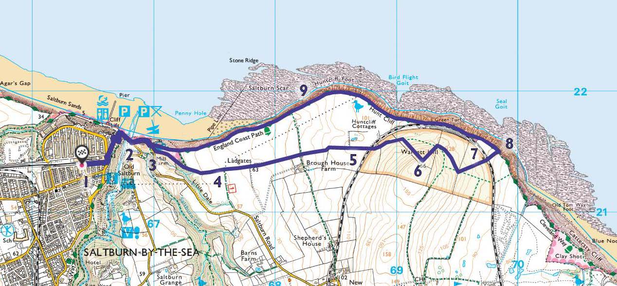
Come Walk out of Saltburn train station, turn left down Dundas Street East and turn left at the junction with Marine Road and Glenside. Using the traffic island, cross over Saltburn Road, and then across Marine Road. Turn left to carry on along Marine Road as it drops down towards the sea. Follow the road as it winds its way to the coast and follow it sharp right opposite the car park when it finally reaches the bottom.
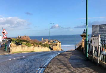
Step 2
Walk beneath the restaurant above, and over the ridge which takes Skelton Beck out to the sea. At the road junction, ignore the right turn and carry on along Saltburn Road to walk along the coastline. Just after The Ship pub and its car park, take the path on the left.
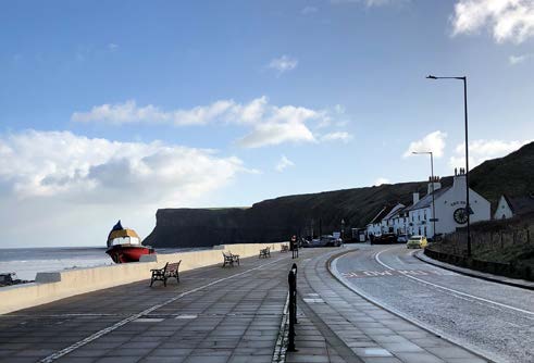
Step 3
Straightaway, this path splits into two. The Cleveland Way / England Coast Path is on the left, but you want the one on the right – marked by a public bridleway sign, a blue cycling sign for Brotton and Staithes, and a National Trust sign. Walk up this path which climbs fairly steeply and turns left – with the valley of Little Dale below on the right. This section is also the National Cycle Network route – which runs between Dover and the Shetland Islands.
Step 4
Not far after some cottages, the cycle route takes a right – but you continue straight on. A farm track from the right soon takes over from the footpath as you pass a farm. Follow this track and just as it turns right, take the footpath on the left. Continue on this path as it double bends, until you get to the railway line.

Step 5
Go through the gaps in the hedges and carefully cross the railway line, looking and listening in both directions as you do. Straight ahead is Warsett Hill, and as this is Open Access land you can walk up to the summit any way you wish - but the best way is to head for the gap in the hedge pretty much straight ahead of you. Once through, follow the clear track as it passes through a gap in the next fence – and then turn right to climb to the summit. You are now roughly halfway through this North Yorkshire Coastal Walk.

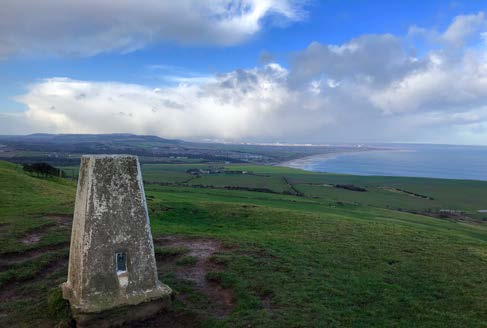
Step 6
The summit of Warsett Hill is at the triangulation pillar and is the highest point on this part of the coast at 166 metres high. The sights from the top are stunning, despite not being too high. Once you are ready to descend, follow the fence on your right down the hill, and go through the gap in the fence. Follow the clear path as it heads towards the far fence, and go through the gap.
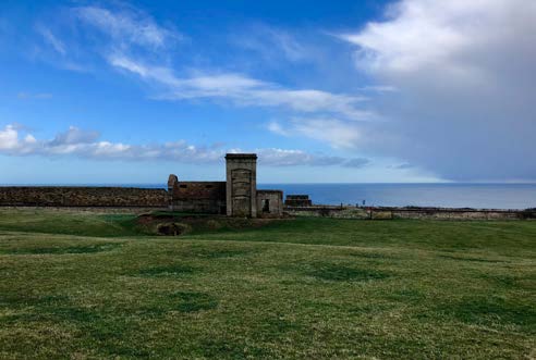
Step 7
Walk toward the building on the left and investigate the remains of this old Fanhouse (remains from part of the Huntcliff ironstone mine), before carefully crossing the railway line again through the gates (again carefully looking and listening in both directions). Follow the clear path across the field and over the stile. This is now the Cleveland Way / England Coast Path. Before heading off, have a look at the information board which explains more about the buildings and the coasts’ heritage.
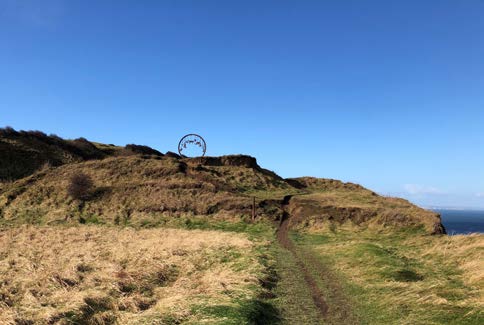
Step 8
Turn left and head along the Cleveland Way as it hugs the coastline around the bottom of Warsett Hill. Parts can be a bit boggy and muddy, so take care. Soon, on the left, is a circular sculpture – this is the “Charm Bracelet” – one of three sculptures at Huntcliff. After stopping to look, carry on along the Cleveland Way.
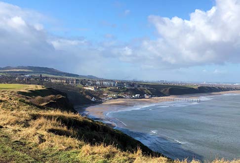
Step 9
The path hugs the shoreline here, between the North Sea on the right and the railway on the left. Soon, the railway moves away to the left and the path is right on the cliff edge. Eventually pass through some gates and stiles and you will drop down to meet the bridleway you took at the start of the walk on your left. At the road, turn right, and retrace your steps to the station by following Saltburn Road back to the top. Congratulations, you’ve completed the Saltburn, North Yorkshire coastal walk!
We hope you enjoyed our recommended Saltburn Walk in North Yorkshire! Looking for more walks or hikes in Northern England? See them here.
More to find in City and Country Walks
Northern App
Streamline your journey and get tickets straight to your phone. Making your journey contact-free.
Northern App
Streamline your journey and get tickets straight to your phone. Making your journey contact-free.